Atlantis Image Gallery
The following figures are some examples of the services
Atlantis Scientific Inc. is able to provide
(Click on the images to enlarge)

|
Figure 1 - Example of DEM (Digital Elevation Model) production (Goose Bay, Labrador)
Image Size 312K |

|
Figure 2 - Example of Deformation Mapping in the Belridge Oil Fields (Belridge, California)
Image Size 220K |

|
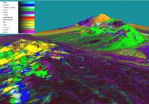
Figure 3 - Example of Hyperspectral Mapping. Here, minerals are delineated by spectral signature (Cuprite, Nevada - AVIRIS Data provided by CCRS)
Image Size 380K |

|
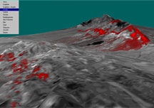
Figure 4 - Example of Hyperspectral Mapping. Here, the mineral "Alunite" is separated from the rest and highlighted (Seen as Green in Figure 3)
Image Size 205K |

|
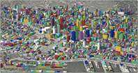
Figure 5 - Example of Optical High Resolution Mapping (Montreal, Quebec - Data courtesy of Vexcel Corp.)
Image Size 653K |
|

